
 Small cranberry, Vaccinium oxycoccos, can be found in peat or acidic soils, which gives it its other common name, bog cranberry. This is one of the first plants to colonize burnt bogland and native Americans would burn bogs to stimulate its growth. Like the cultivated cranberry, these are tart. Naturally, this fruit is sought after by wildlife. This plant is on Little Moose Island at the tip of Schoodic peninsular in Acadia National Park. Click on the image for a larger view.
Tag Archives: Native American Culture
Cycles of Life—Canyon de Chelly
 While Canyon de Chelly is a national monument, it is owned by the Navajo tribe. Squash, corn, apples, and peaches are grown on the land. Horses and sheep pasture here. And as ever, it is a source for their cultural and spiritual heritage.
Time & Space—Canyon de Chelly
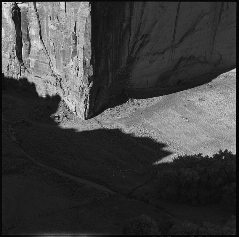
 Canyon de Chelly is a layered tapestry in time and space. The rock ledge in the bottom left corner of the image is about 100ft/30m below me. The canyon floor is several hundred feet more. Cottonwood trees, with their bright autumn foliage, mark water running below the surface of the land. Paths and roads trace the passage of the residents, human and animal.
Stone & Symbols—Canyon de Chelly
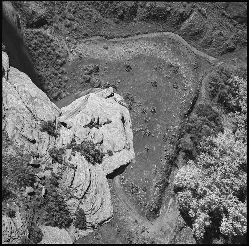
 The canyon walls are sliced from De Chelly sandstone. Formed during the late Permian Period, about 200 million years ago, the stone still reflects the ancient sand dunes that created them.
The walls also are a canvas for petroglyphs, images and symbols chipped into the stone. Petroglyphs are difficult to date. Both the Anasazi and Dineh (Navajo) practiced this art. These images can commemorate an event, mark a trail, or hold deep spiritual or religious significance in rites or initiations. This section of the canyon wall near Antelope House Ruin has petroglyphs scattered over its surface. Click on the image for a larger view.
Antelope House Ruin—Canyon de Chelly
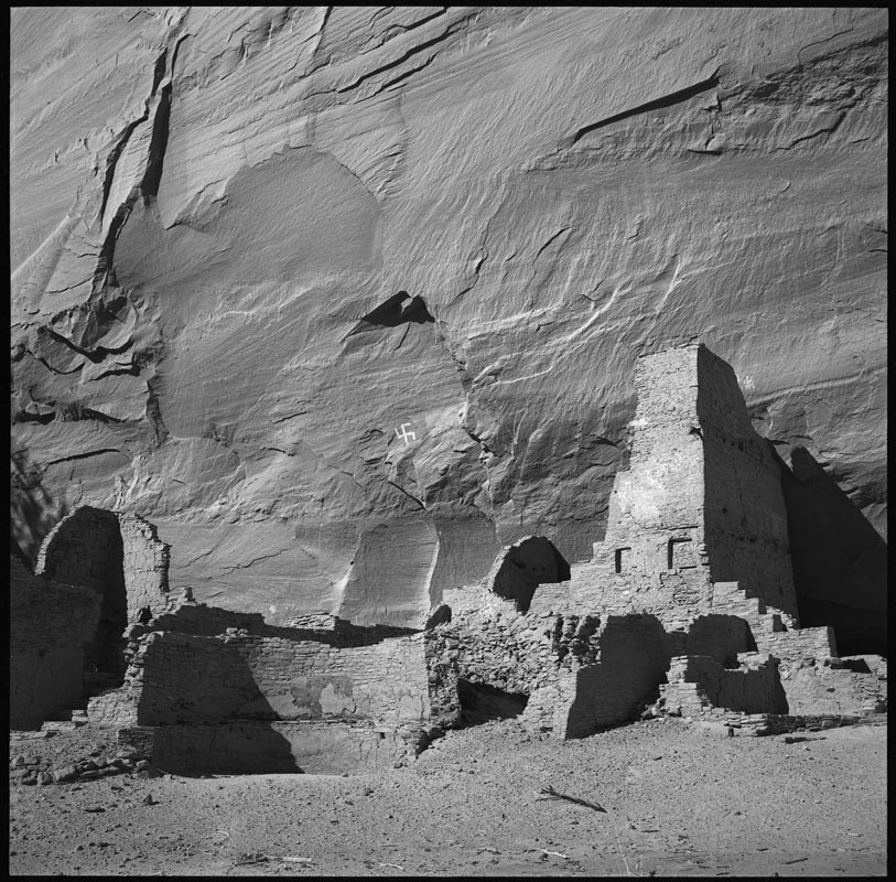 Before the Dineh, or Navajo, arrived in Canyon de Chelly, the area was home to the Anasazi, a name given to them by the Dineh meaning “ancestors of the enemy.” The Anasazi settled the area sometime in the first century.
Antelope House Ruin is from the Great Pueblo Period or Pueblo III period, beginning around the 1100s when large settlements were being built. The two-story tower suggests these places were fortifications—some built high up on the canyon walls. The round wall at the left of the tower is the remains of a kiva that played a ceremonial or religious role in the community. Even with these large constructions, it seems that most of the population still lived in small dwellings outside these structures.
It is unclear whether the swastika on the canyon wall is from the Anasazi or Dineh. The Hopi, a descendant of the Anasazi, use this symbol as a representation of their migration story. For the Dineh, it is used in healing rituals.
By the beginning of the 1300s, the Anasazi had gone from Canyon de Chelly. Studies of tree rings shows there was a sever drought from 1276–1299. There is some evidence that over population and stress placed on the environment may have contributed to their decline as well. The modern Pueblo tribes of the Hopi, Zuni, Acoma, and Leguna are believed to be the descendants of the Anasazi.
Spider Rock, Speaking Rock—Canyon de Chelly
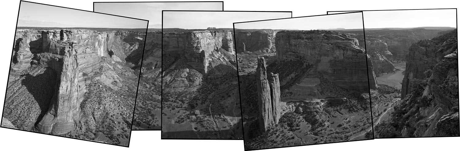 Spider Rock in Canyon de Chelly National Monument is one of the most recognized sites in the American Southwest. This is the spiritual and geographic center of the Dineh, also known by their common name, Navajo.
The tower in the center of the image is Spider Rock. This is the home of Spider Woman. She helped rid the world of monsters and gave the Dineh the gift of weaving; an art form at which these people excel.
Speaking Rock or Talking Rock is at the tip of the butte on the left on the image. The Dineh have a children’s story where it is said that Speaking Rock will tell Spider Woman which children have been naughty. Spider Woman will take these children to her rock and eat them. The paler colored rock at the top of her tower is thought to be the bleached bones of these unfortunate kids.
Canyons are cut from plateaus. We are really not looking at tall features, but deep ones. The canyon floor is about 1,000ft/300m below the rim at this point. If you look at the horizon near the center of the panorama, you can see a mountain called Black Rock. That is a volcanic plug; the core of a volcano which is left after the sides have been eroded away.
Click on the image for a larger view.