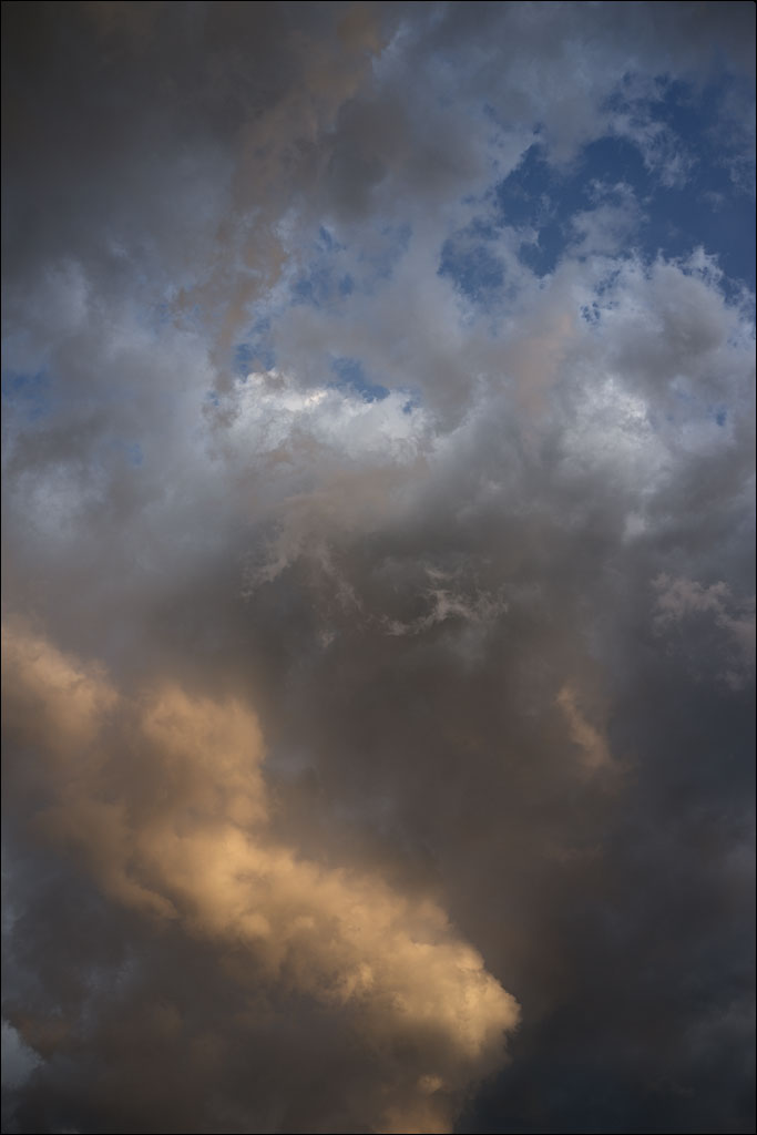
 We refer to the space above our heads as the sky. Yet, our word comes from the Old Norse ský. A word that means clouds, not the space that contains them. Click on the image for a larger view.
Author Archives: HakusanCreation
Ōkeanos
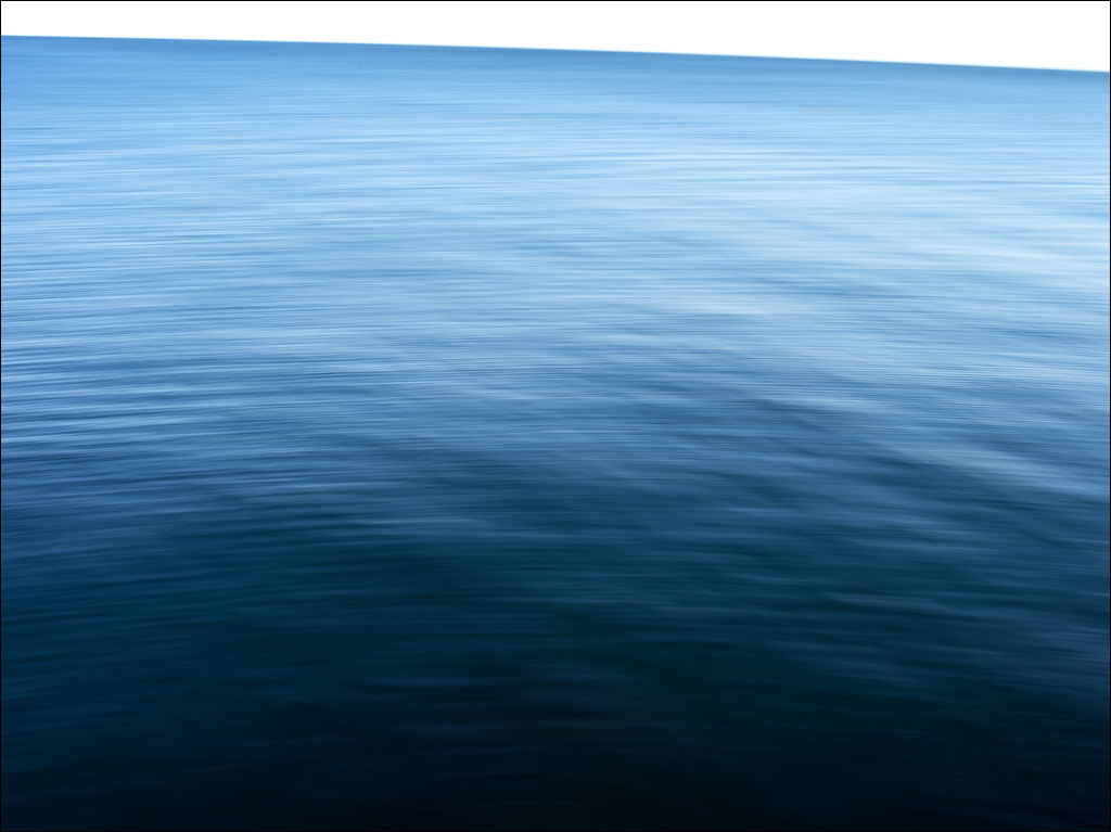 Ōkeanos is the Greek for “the great stream encircling the Earth’s disk.” This word was transformed in middle English to the word we are familiar with: ocean. Click on the image for a larger view.
Mangroves
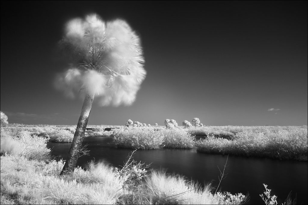
 Mangroves on Black Point in Merritt Island National Wildlife Refuge. Click on the image for a larger view.
Black Point
 Black Point on Merritt Island Florida. Click on the image for a larger view.
8th Annual Photobook Show
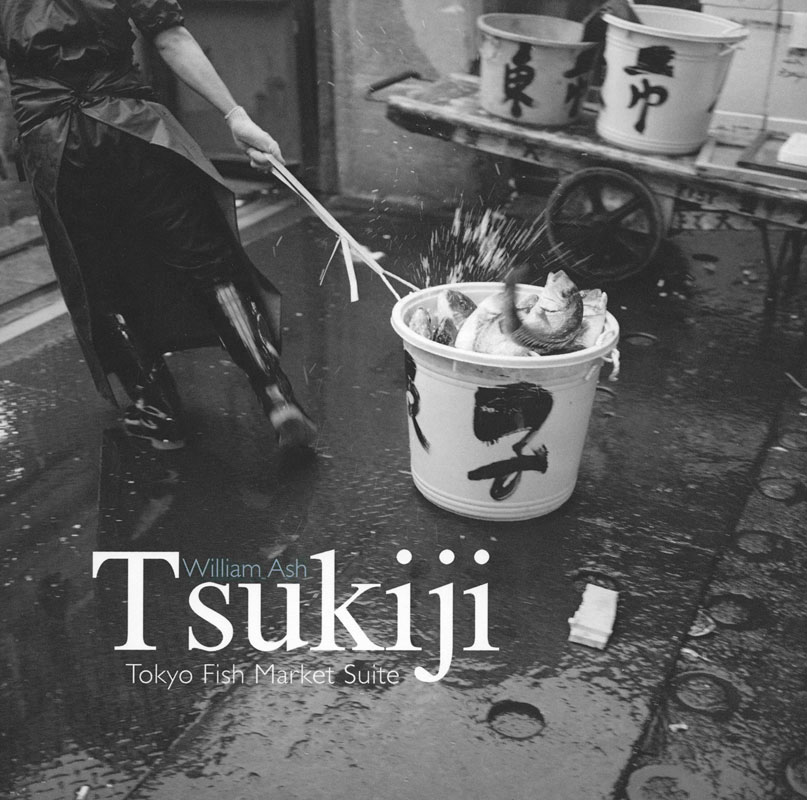 Starting today, our book Tsukiji: Tokyo Fish Market Suite will be on exhibit at the Griffin Museum of Photography in Winchester, Massachusetts. Please stop by and visit this wonderful museum.
Tokyo Gate Bridge
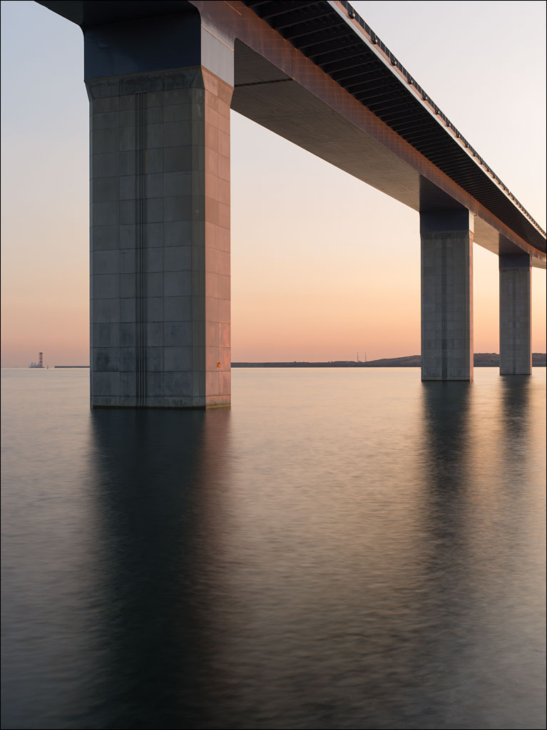 If there was a defined edge to the city of Tokyo, this would be it. Tokyo Gate Bridge is the furthest public highway built out into Tokyo bay. The island on the horizon is Chuo Bohatei, Tokyo’s largest landfill, which is reaching the edge of the municipality’s border. This image is from Earth, Water, Fire, Wind, Emptiness: Tokyo Landscape. The image is also an optical illusion: can you tell if the bridge piers are getting thinner or taller the further away they are? Click on the image for a larger view.
Edogawa
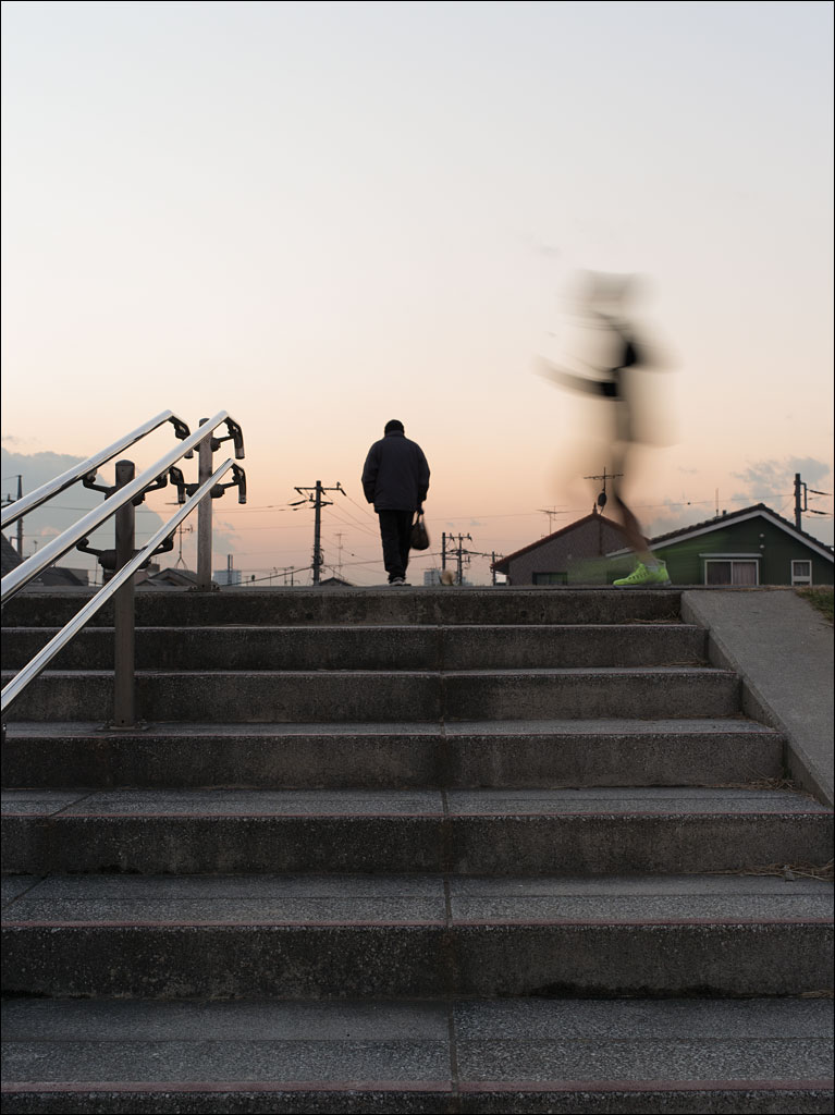 The levee along Edogawa or Edo river is 10m or 30 ft. above the river course. The land on the other side is near sea level. The population density for this Tokyo ward is 13,900 people/km² or 35,900 people/sq. mi. Millions of people are protected from riverine flooding by these structures. This image is from Earth, Water, Fire, Wind, Emptiness: Tokyo Landscape. Click on the image for a larger view.
Jyonanjima
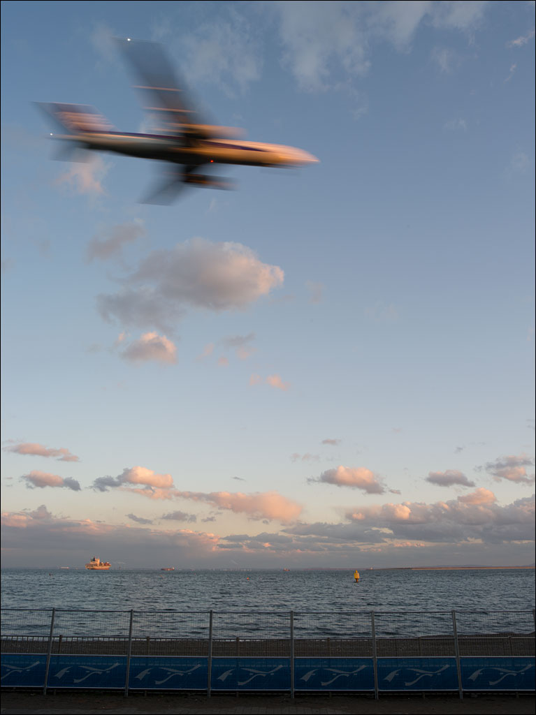 Jyonanjima Seaside Park is built on an artificial island in Tokyo bay. Since this island lies on not only the busiest shipping route into Tokyo harbor, but also along one of the flight paths to Haneda International Airport, its popularity is surprising. And while it is one of the few places residents of the city can enjoy a sand beach, the water is too hazardous to allow swimming. Click on the image for a larger view. This is from our book Earth, Water, Fire, Wind, Emptiness: Tokyo Landscape.
The Color of Night

Wasp
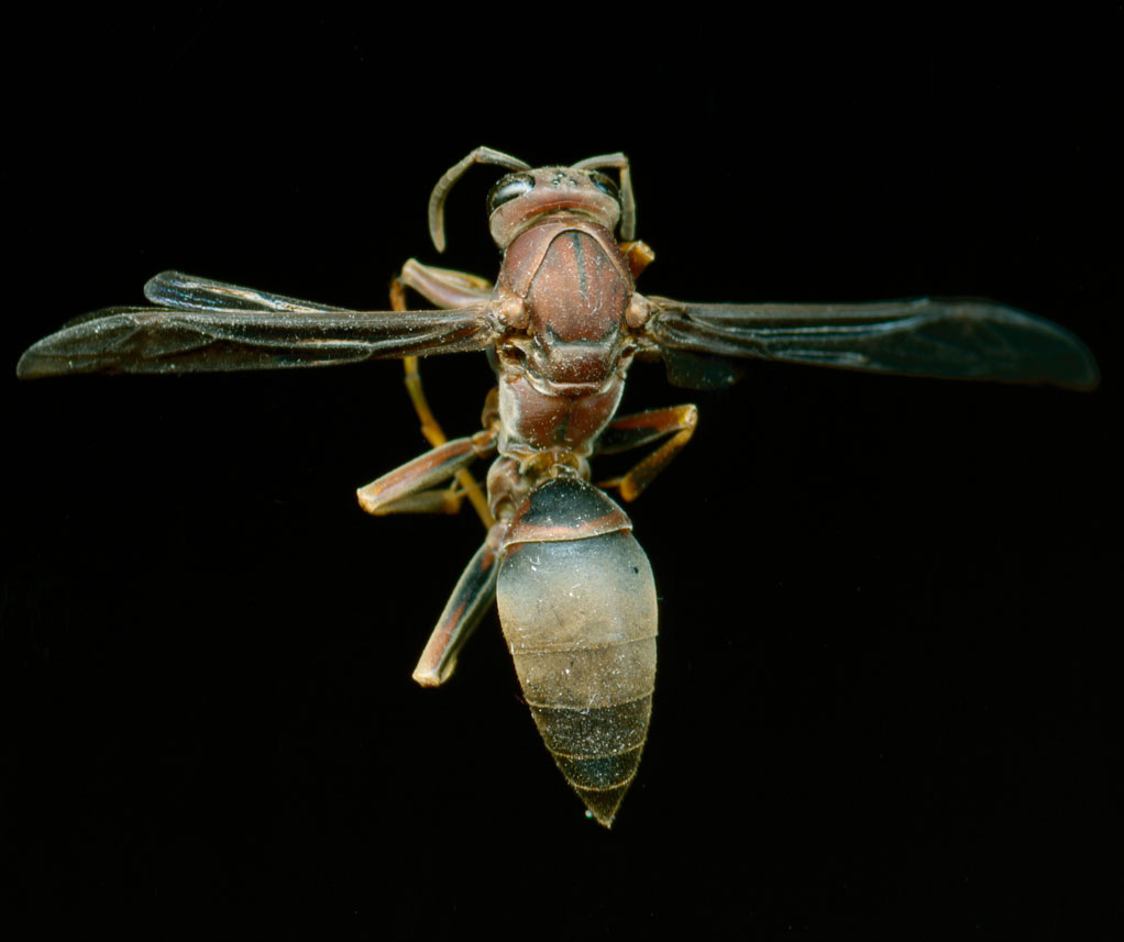 I am not sure the type of wasp, but we found the remains just on the inside of our window. It is missing two of its wings, but apart from that, it is it good shape. At first appearance, it seem rather plain, but under closer inspection, the markings and structure are beautiful. As with most insects, this wasp also has three primitive eyes between its larger primary compound eyes. Click on the image for a larger view.