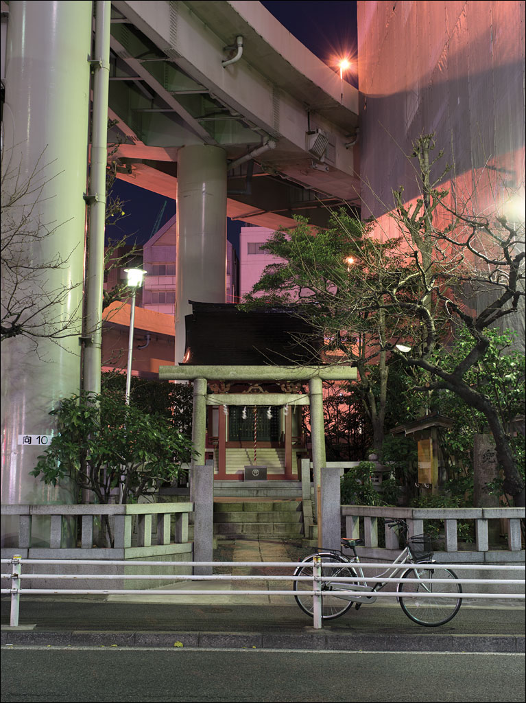
 Kabuto Jinja under the Shuto Expressway, Chuo-ku, Tokyo. This shrine faces the Tokyo Stock Exchange. From the book Earth, Water, Fire, Wind, Emptiness: Tokyo Landscape. Click on the image for a larger view.
Tag Archives: Earth Water Fire Wind Emptiness
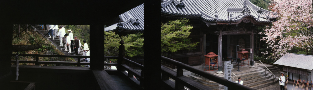
Sacred Spaces, Part 2
 The entrance to Atago Jinja, founded in 1603, marked by the shinto Tori gate or Torii. Built on one of the highest points in Edo overlooking the bay (26 m, 85 ft.), the shrine was famous for its views. Today, that view is obscured by buildings. The fire god Homusubi-no-mikoto is the main deity, reflecting how deadly and feared fires were to the Edo population. From the book Earth, Water, Fire, Wind, Emptiness: Tokyo Landscapes. Click on the image for a larger view.
Sacred Spaces, Part 1
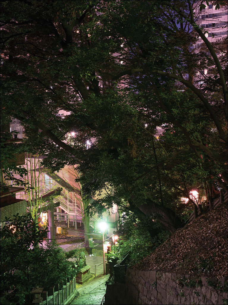
 Shusse Inari Jinja, Bunkyo-ku, Tokyo. The shrine was founded in 1620 by Lady Kasuga, a powerful woman in the Tokugawa Shogunate. The sound that periodically sweeps through the shrine is a cross between wind and thunder—the noise of the Thunder Dolphin roller coaster, the structure in the background, as the cars pass the gap between the buildings. From the book Earth, Water, Fire, Wind, Emptiness: Tokyo Landscapes. Click on the image for a larger view.
Sumida River
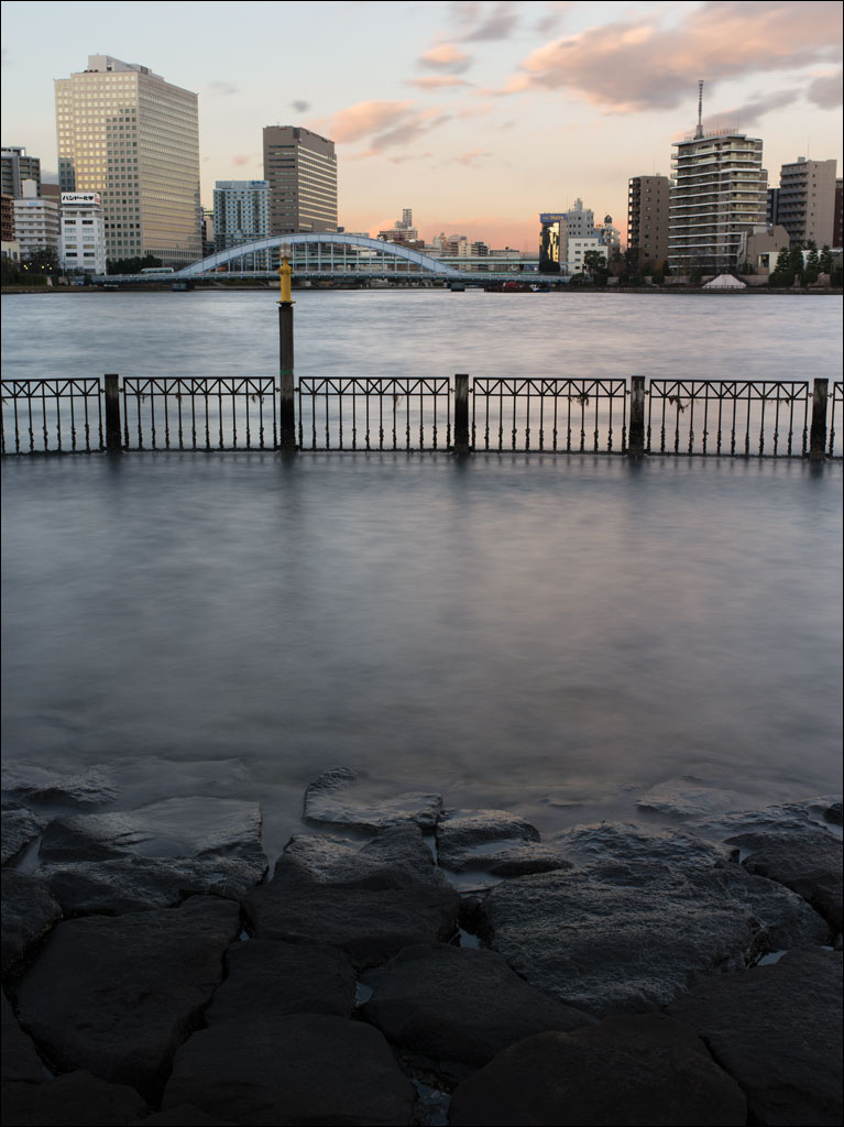 Ishikawajima Park at the tip of Tsukishima, an island made in 1892 from material dredged for a shipping channel in Tokyo bay. From our book Earth, Water Fire, Wind, Emptiness: Tokyo Landscape. Click on the image for a larger view.
Tokyo Bay Seawall
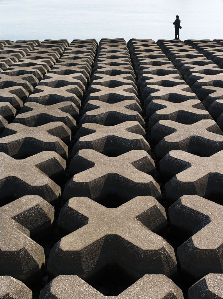 The defense along the artificial islands in Tokyo Bay. From our book Earth, Water, Fire, Wind, Emptiness: Tokyo Landscape. Click on the image for a larger view.
Shinbashi, Tokyo
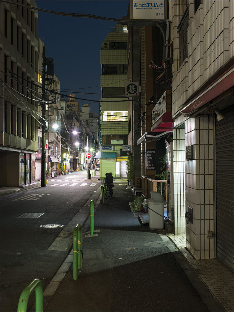 A solitary figure is standing in the usually vibrant district of Shinbashi, Tokyo. Unlike Ginza, its exclusive neighbor to the north, Shinbashi caters to the average Tokyo worker with reasonably-priced restaurants and bars. This is from our book Earth, Water, Wind, Fire, Emptiness: Tokyo Landscape. Click on the image for a larger view.
Tokyo Station
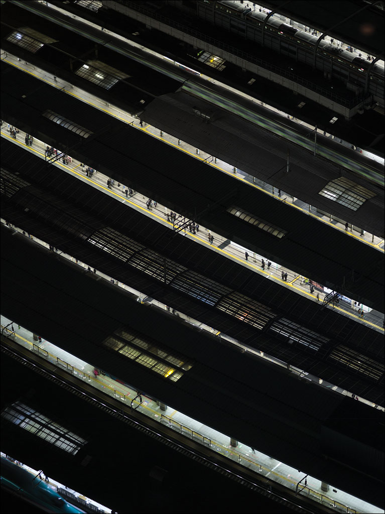 Tokyo Station at night after the rush hour. When it opened in 1914, half a million passengers used the station in the first year. Today, 420,000 people pass through daily on over 3,000 trains. This is not the busiest station in Tokyo. From our book Earth, Water, Wind, Fire, Emptiness: Tokyo Landscape. Click on the image for a larger view.
Shinobazu no Ike
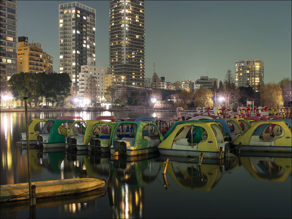 Shinobazu no Ike, or Shinobazu Pond, is located in Ueno Park, Tokyo. This is all that remains of the marsh that has been filled since Edo was established in the seventeenth century. The eastern part of Tokyo was reclaimed from this marsh and is protected by a series of flood walls. During World War II, the pond was used for growing rice. After the war, discussions on whether to convert the area to baseball fields were held. Boating on this pond goes back to 1931. This image is from our book Earth, Water, Fire, Wind, Emptiness: Tokyo Landscapes. Click on the image for a larger view.
Number 3 Daiba
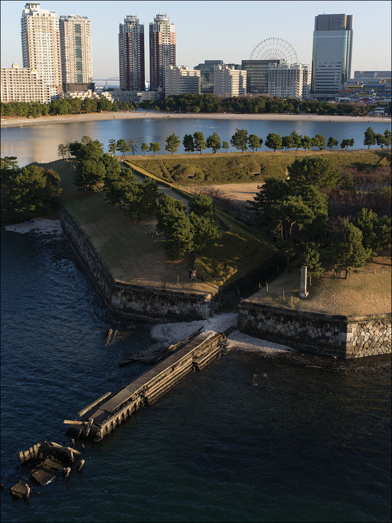 What looks like a peaceful Japanese garden is Number 3 Daiba, a fortification built in 1853 as a response to attempts by US Commodore Perry to open Japan. Beyond that is the artificial island of Odaiba, which was constructed after World War II and one of the planned sites for the 2020 Tokyo Olympic Games. Between the two high-rise apartment building on the left is Tokyo Gate Bridge, the furthest extent of the city into the bay. Number 3 Daiba was originally built several kilometers off the coast of the city in open water. This image comes from our book Earth, Water, Fire, Wind, Emptiness: Tokyo Landscapes. Click on the image for a larger view.
Kasai Rinkai Park
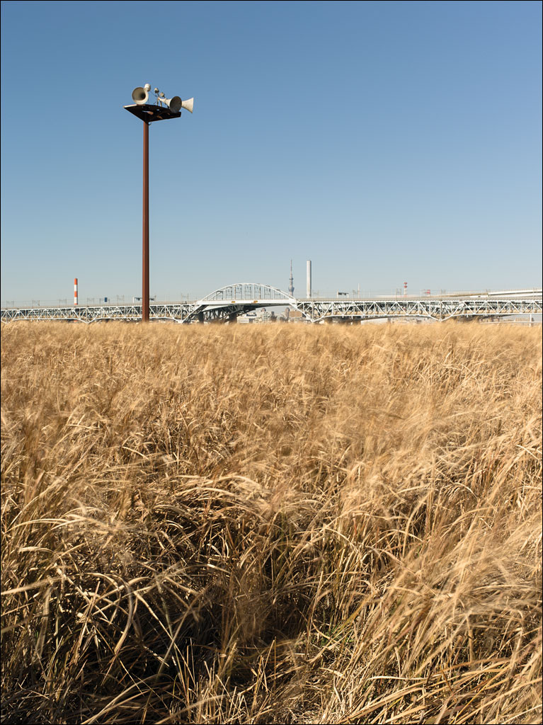 Kasai Rinkai Park is on Tokyo Bay. It is an artificial island built to preserve the natural habitat of Tokyo bay destroyed by development. The bridge in in the background is the main highway that connects Tokyo with Chiba, Tokyo Disneyland, and Narita International Airport. The loudspeakers on the post warn people of approaching tsunamis. This image is from our book Earth, Water, Fire, Wind, Emptiness: Tokyo Landscape. Click on the image for a larger view.