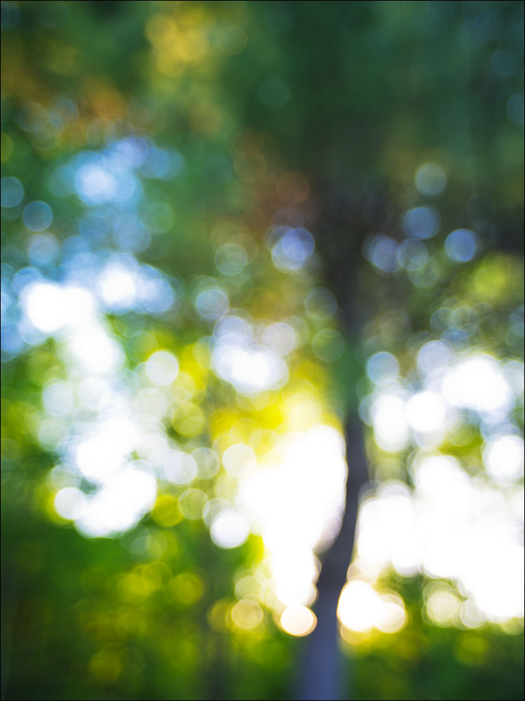
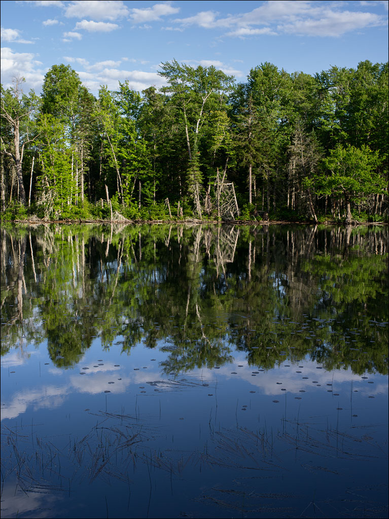
 Summer is the season of liquid light—forms and edges seem to melt away. Our forest becomes a chapel dedicated to a goddess of color. Click in this image for a larger view.
Tag Archives: Nature
Height of the Land
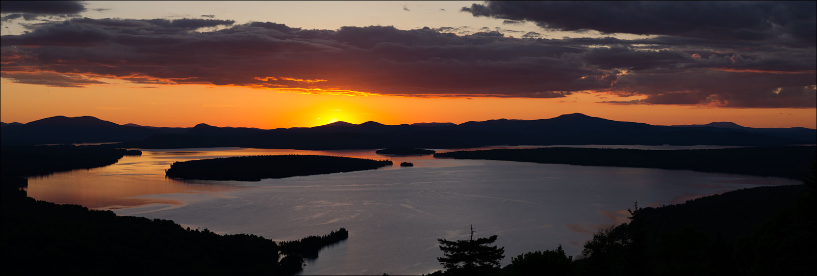 Height of the Land in Rangeley is a magical place. Overlooking Mooselookmeguntic Lake, this spot makes you feel like you are standing at the top of the world. Click on the image for a larger view.
Mooselookmeguntic Lake is the forth largest lake in Maine, covering an area of 25.5 square miles or 66 square kilometers at an elevation of 1,467ft or 477m. It is part of the Androscoggin watershed. The name come from the Abenaki meaning “moose feeding place.” That evening, as we were leaving, we spotted a female with her calf.
Mountain Sky
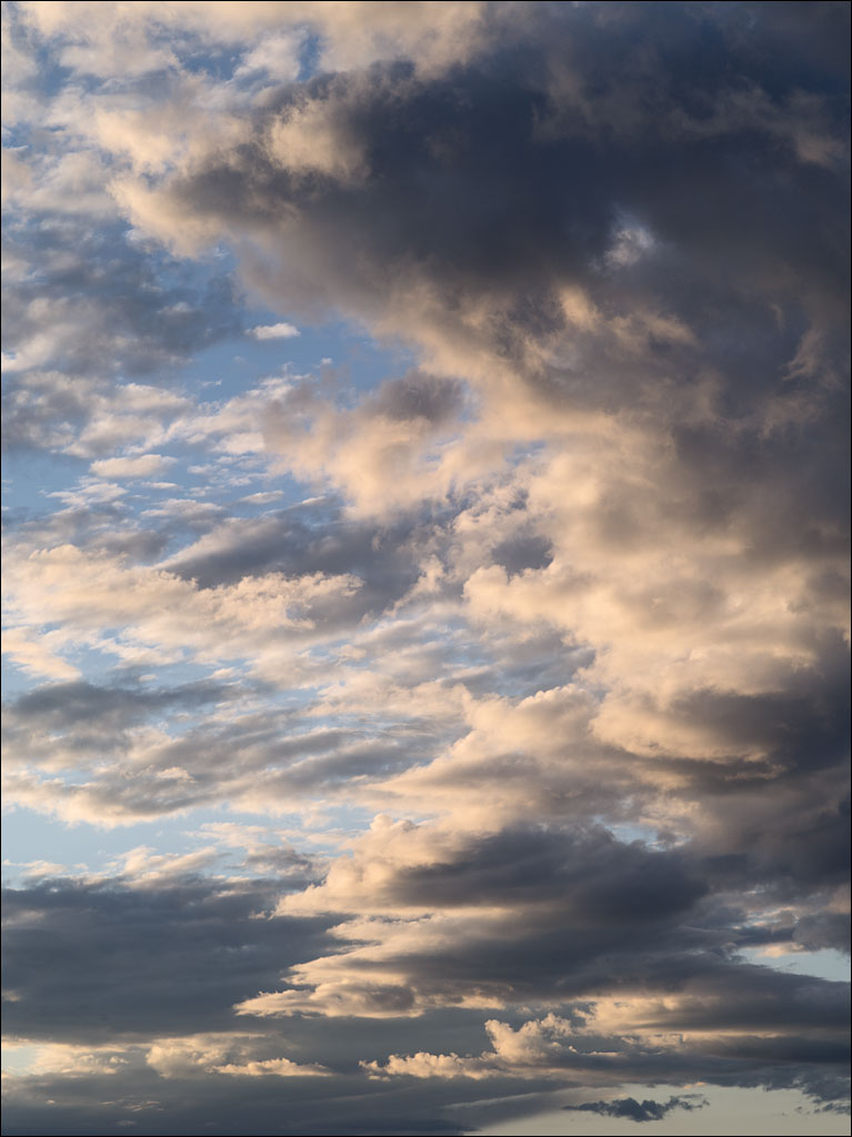 Our Sunday trip to western Maine ended in Rangeley. Mountain skies always seem special. Their ephemeral forms fascinate me. Clouds create an illusion of substance, but, within the space of a few minutes, can dissipate into the air that bore them. Click on the image for a larger view.
The Source of the Androscoggin
 Not far from Grafton Notch State Park, Umbagog Lake straddles the border of Maine and New Hampshire. This lake is the source of the Androscoggin River, which flows through New Hampshire and into Maine, eventually joining the Kennebec River at Merrymeeting Bay before emptying into the Gulf of Maine and the Atlantic Ocean. The name of the river is thought to come from either the Eastern Abenaki or Penobscot tribe.
Textile and paper mills nearly killed the river, but it has slowly been recovering since the enactment of the Clean Water Act, which the Androscoggin inspired. While great strides have been made to improve the condition of the Androscoggin (it was once known as the “Andro-stinkin” and just swimming in the river would make you sick), industrial pollution down stream is still a serious problem. Click on the image for a larger view.
Bear River
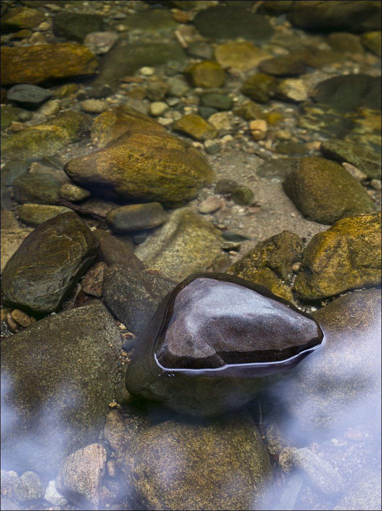 Bear River flows though Grafton Notch State Park. Click on the image for a larger view.
Screw Auger Falls
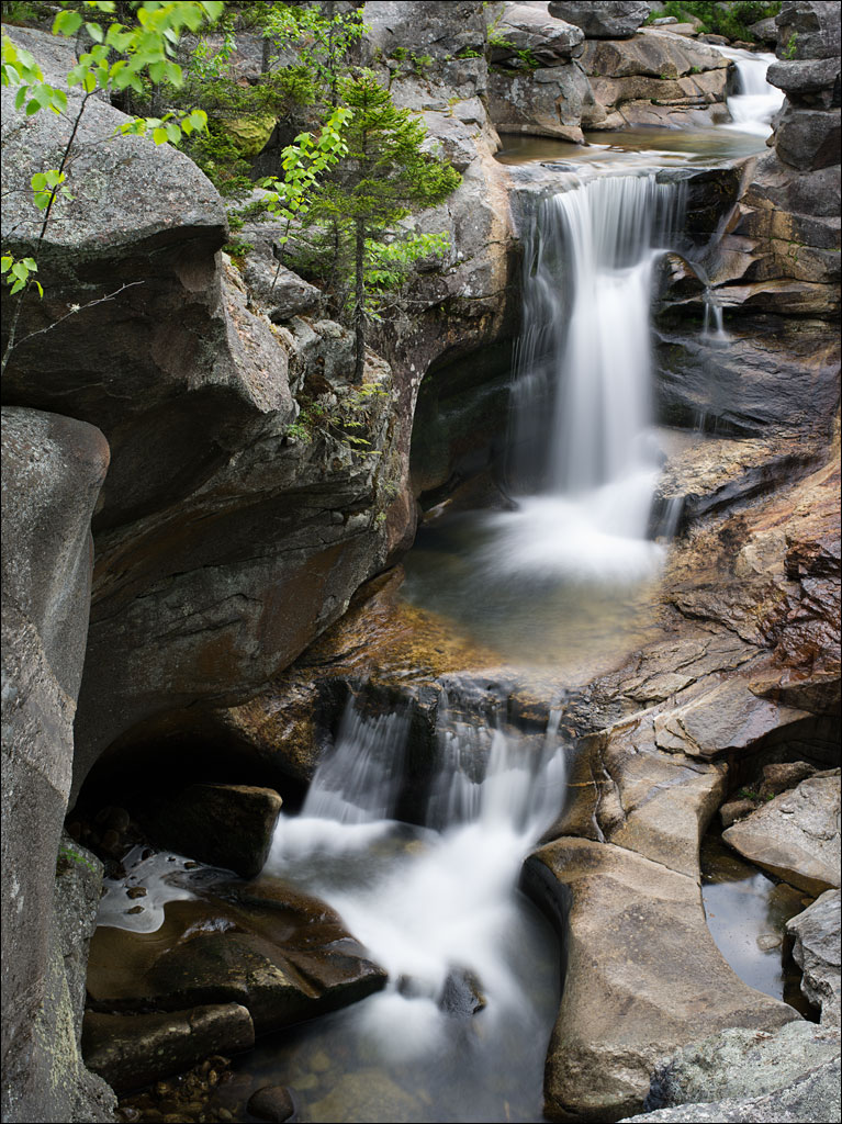 Yesterday, Naomi and I took a trip out to Grafton Notch State Park in western Maine near the New Hampshire border. The park is home to Old Speck mountain. The Bear River descends into a valley on the eastern side of the notch. Screw Auger Falls is one of a series of waterfalls along the course of the river. Click on the image for a larger view.
Lupine
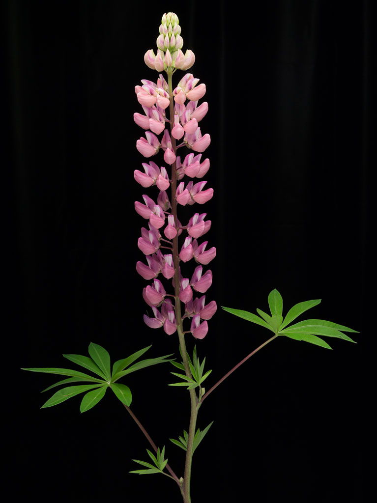 Lupine, Lupinus, is a symbol of summer in Maine. The common blue variety can be seen along the roadsides throughout the state. It is an elegant plant—the tip extends upwards as the blossoms unfurl. The flowering head takes a wonderful color gradient as the blossoms darken with time. Click on the images for a larger view.
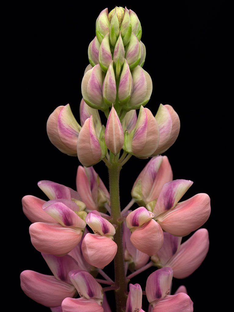
Maple Seeds
 One of the great joys of summer is maple seeds, those wonderful natural helicopters that children love to play with. This seed is from a silver maple, Acer saccharinum L., and is about 2.4 inches (6 cm) long. What can a tree know of aerodynamics? Click on the image for a larger view.
Summer Wind, Summer Forest
 Yesterday was beautiful. I believe that trees evolved to be tall simply to play and dance in the wind. Click on the image for a larger view.
Where the Land meets the Sea, part 5
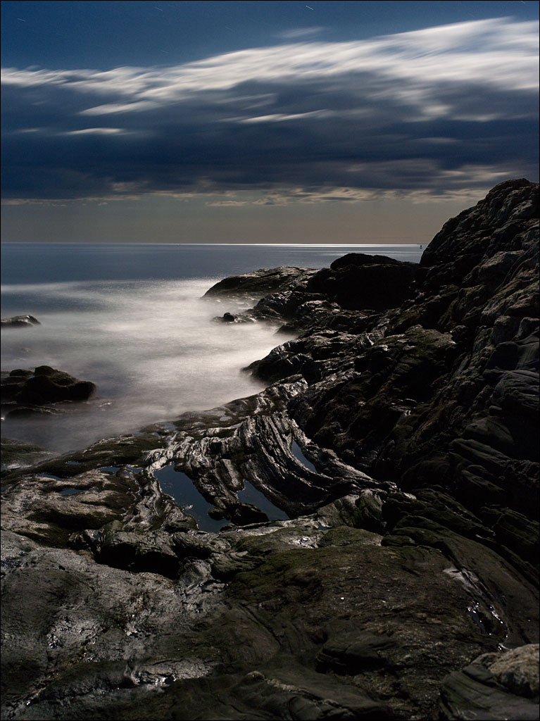 On a moonlit night at Pemaquid Point, two figures look out to sea. A soft wind presses against their bodies. The rhythm of breaking waves fills the air. “I would love to spend the rest of my life searching for beauty,” whispers the woman to the man.
Click on the image for a larger view.