
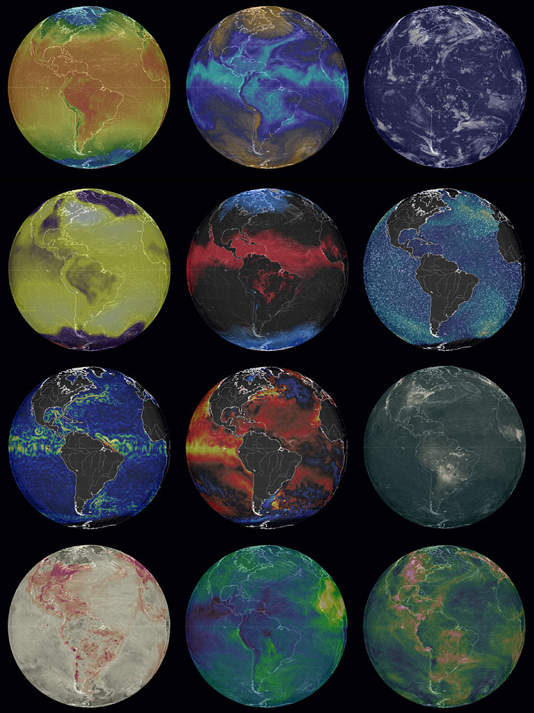
 Earth Wind Map is one of the neatest visualizations and interactive maps I have seen. You can see current data of ocean currents, particulate extinction, chemical extinction, temperature, cloud water, relative humidity, and a bunch or other stuff including wind. You can turn the globe, or whatever projection you chose (there are several), and zoom into areas. Simply click on the button labelled Earth to select the options—the top of that dialog box tells you what you are looking at. The data are updated every three hours. You could click on my image composite of their projections or, better still, go to the site. This is something worth bookmarking.
Lost Varieties—Apples of Maine
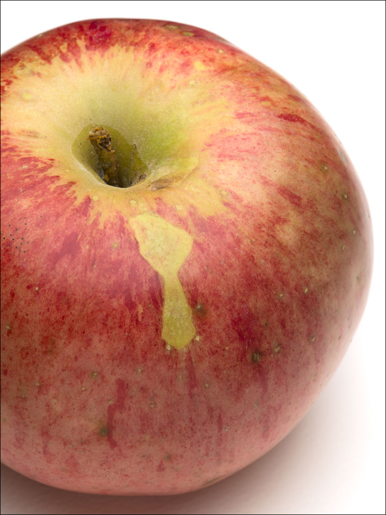 Throughout Maine are lost varieties of apples growing in old fields. While our supermarkets limit our choice, usually red, yellow, and green, thousands of apple varieties have been cultivated. Some have been saved in seed banks and specialty orchards, but many have been lost to time and memory—it can be hard to identify an apple by appearance.
We have one lost variety on our land. It fruits biennially and produces large, round apples. The flesh is white and very light; despite the size, they do not weight that much. It is not a sweet apple, but neither does it have a sharpness of a Granny Smith. Lemony would be a good description. If you cook it, it takes on a pleasant sweetness, but it does not retain its shape. We eat this raw or make apple sauce for itself or as pie filler. Click on the image for a larger view.
Trees, Wind, and Light
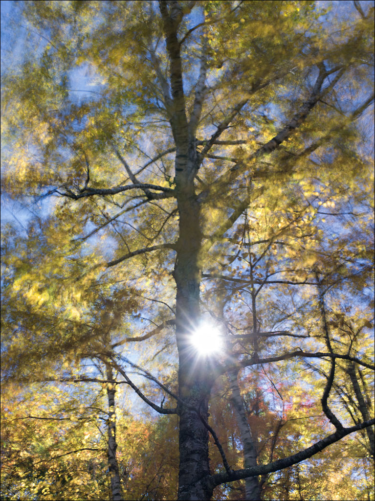 The foliage is changing quickly in our forest. Click on the image for a larger view.
Home and Homelessness Opening
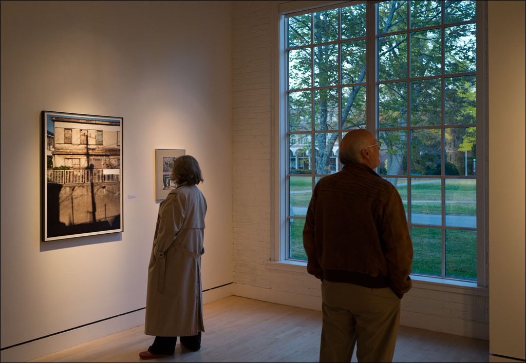 Last Friday was the opening reception for the Visualizing Home and Homelessness exhibition at Lord Hall Gallery at the University of Maine, Orono. The picture on the left is my submission, a work from the Earth, Water, Fire, Wind, Emptiness project. Please stop by if you are in the area. Click on the image for a larger view.
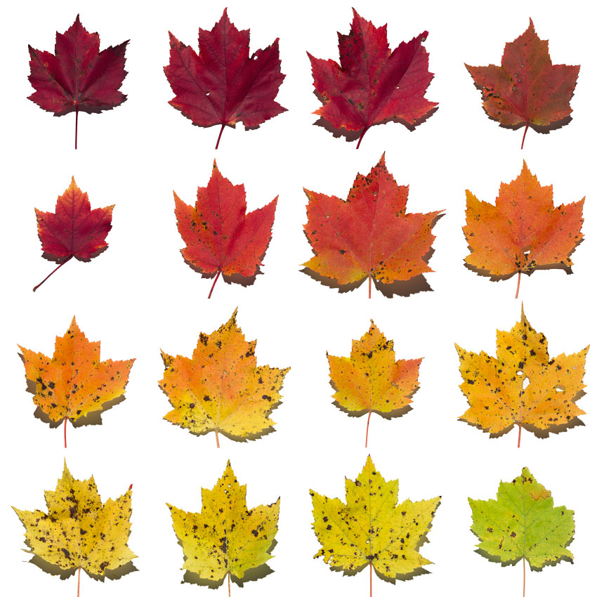
Red Maple Spectrum
 Inspired by my maple leaves, this images represents the spectrum of the Red Maple tree. These colors can be present at one time throughout the foliage. Click on the image for a larger view.
My Book Reviewed at Japan Camera Hunter
I was pleasantly surprised to see a short review of Earth, Water, Fire, Wind, Emptiness at Japan Camera Hunter: you will need to scroll to the bottom of the page. Thank you Bellamy Hunt.
Fall 2015
 These leaves are from a single red maple tree in our garden—all taken at the same time. This tree is usually one of the first to show its fall foliage. Click on the image for a larger view. If you would like to see the tree… Continue reading
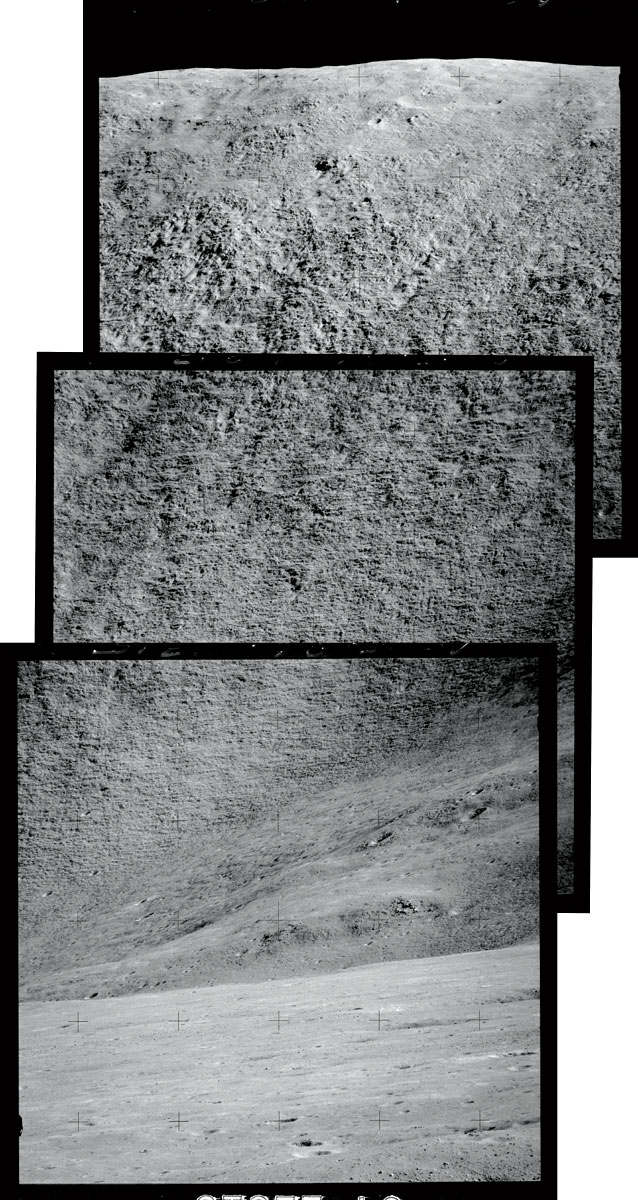
Craters of the Moon
 Apollo 16 landed on the highlands of the moon. This is an image of one of the Cinco Craters on the slope of Stone Mountain, which was 2.4 miles or 3.8 km from the lunar lander and about 500 ft or 150 m above the landing site. Some of the oldest rock samples from the moon were taken from this region. The lunar landing crew were John Young and Charles Duke, with Thomas Mattingly remaining in orbit. Click on the image for a larger view. Continue reading
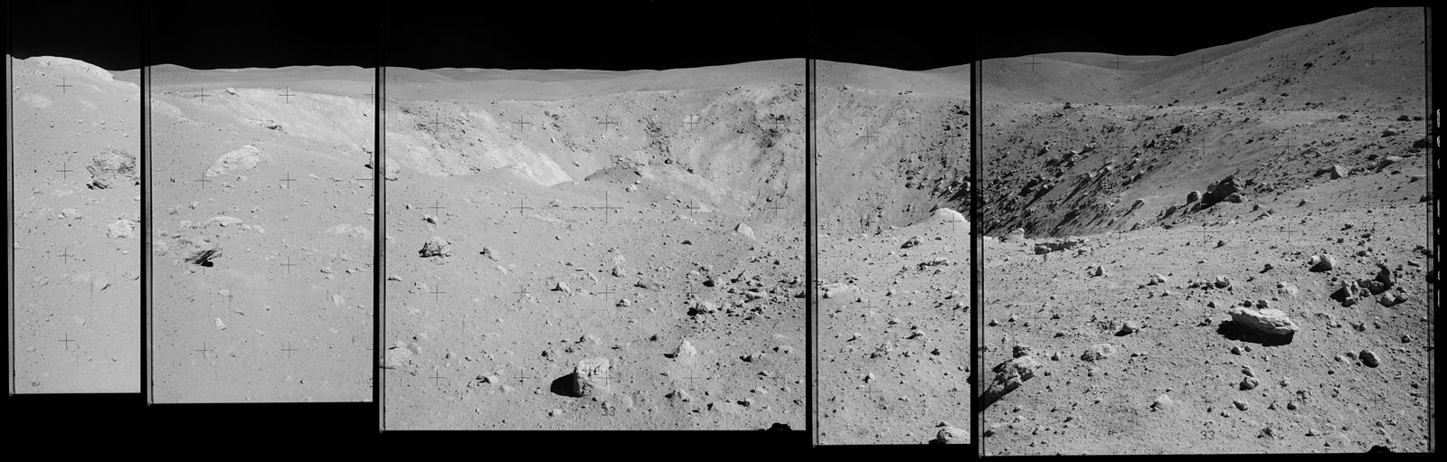
Mountains of the Moon
 Apollo 15 was the first mission to use a lunar rover. One of the mission destinations was Rima Hadley. This sinuous rille, a river-like channel, is about 80 miles or 120 km in length and rises about 1,200 ft. or 370 m from the landing site. I created this composite of the side of Rima Hadley from images from NASA’s Project Apollo Archive. David Scott and James Erwin were the lunar crew, with Alfred Warden remaining in orbit. Click on the image for a larger view.
Walking on the Moon
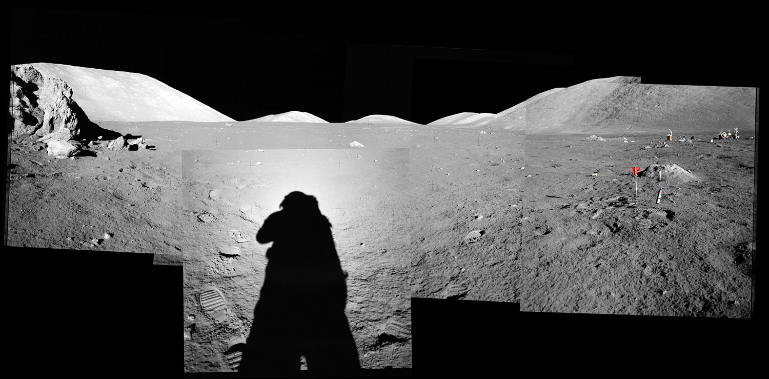 Apollo 17 was the last manned mission to the moon. In 1972, Eugene Cernan and Harrison Schmitt descended in the lunar lander, while Ronald Evans remained in orbit. This is a composite I created from seven images from the NASA’s Project Apollo Archive. Click on the image for a larger view. Note the lunar rover on the right of the image.